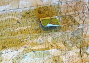
La cartographie parcellaire dans les campagnes d’Ancien Régime (Europe et Amériques) : de la production aux usages.
Rennes, 21-22 mars 2019
Land-Plot Mapping in Early Modern Rural Societies (Europe and Americas): from production to uses.
Rennes (France), 21-22 March 2019

Campus Villejean (métro Villejean-Université), salle Jacques Léonard (Bâtiment A, 3e étage)
Programme
Jeudi 21 mars 2019
9h : Accueil et inscription/Welcome and registration
9h30, Introduction (Annie Antoine)
9h45-12h30 : Panel 1 (président/chairman : Benjamin Landais) La production des cartes parcellaires / Land-Plot Maps Production
9h45, Exposé/Presentation 1 : Juliette DUMASY, Cartes et plans parcellaires en France avant 1550
10h10, Exposé/Presentation 2 : Tomas ČELKIS, Les cartes parcellaires – « nouveaux documents » au Grand-Duché de Lituanie aux XVIe et XVIIIe siècles
10h35, Discussion et pause/ Panel discussion and coffee break
11h15, Exposé/Presentation 3 : Chiara DEVOTI, Les plan terriers (cabrés) de l’Ordre Mauricien: l’arpentage du territoire et la construction d’images d’un statut social
11h40, Exposé/Presentation 4 : Enikő TÖRÖK, The urbarial survey of the royal estate of Óbuda (1777-1778)
12h05, Discussion / Panel discussion
12h30 : Déjeuner/ Lunch
14h00-15h45 : Panel 2 (président/chairman : Boris Deschanel) Cartographie et droits de propriété/ Mapping and Land Ownership Rights
14h00, Exposé/Presentation 5 : William D. SHANNON, Adversarial Mapping in Tudor England
14h25, Exposé/Presentation 6 : Tim SOENS, Maïka DE KEYZER and Iason JONGEPIER, Mapping and the Making of Private Property Rights in rural Flanders, 16th to 18th centuries
14h50, Exposé/Presentation 7 : Elodie PEYROL-KLEIBER, Land grants, patents and plats : obtenir des terres dans la Chesapeake du 17e siècle
15h15, Discussion et pause/ Panel discussion and coffee break
16h15-18h00 : Panel 3 (président/chairman : Tim Soens) Les usages sociaux des cartes parcellaires/ Social Uses of Land-Plot Maps
16h15, Exposé/Presentation 8 : François CHANCEREL, « Juger en jetant un coup d’œil par ce plan ». Le rôle de la carte dans l’aménagement d’une forêt poitevine à la fin de l’Ancien Régime.
16h40, Exposé/Presentation 9 : Boris DESCHANEL, « L’incertitude de soi-même et la défiance de tous » : production et usages socio-économiques des plans d’arpentage à Saint-Domingue au XVIIIe s.
17h05, Exposé/Presentation 10 : Benjamin LANDAIS, La cartographie parcellaire comme instrument de discipline sociale dans le Banat du XVIIIe siècle
17h30, Discussion/ Panel discussion
18h00 : Fin de la première journée/ End of the first day
19h30 : Repas du soir/ Dinner (lieu à préciser/venue to be determined)
Vendredi 22 mars 2019
8h30 : Accueil/ Welcome
9h00-10h45 : Panel 4 (président/chairman : Florent Hautefeuille) Les aspects des cartes parcellaires et leur traitement/ Map Appearance and Map Processing
9h00, Exposé/Presentation 11 : Françoise BRIEGEL ET SEBASTIEN SAVOY, Le cadastre sarde du XVIIIe siècle : standardisation, singularité, esthétique
9h25, Exposé/Presentation 12 : Cyril DAYDÉ / Christine MARY, L’Atlas des mouvances du marquisat de Château-Gontier : étude d’un plan parcellaire du XVIIIe siècle à la lumière croisée de l’œuvre des feudistes et de la cartographie vectorielle
9h50, Exposé/Presentation 13 : Anna GUARDUCCI, Massimiliano GRAVA et Camilio BERTI, From CAtasti.STO.RE. to Cartografia.STO.RE.
10h15, Discussion et pause/ Panel discussion and coffee break
11h15-13h00 : Panel 5 (président/chairman : Nicolas Verdier) Usages, circulations et réutilisations/ Uses, Circulation and Reuse
11h15, Exposé/Presentation 14 : Pieter DE REU, The recuperation and reuse of cadastral practices in the Southern Low Countries and Belgium, 17th c.-19th c. The example of the ‘landboeken’ and the French cadaster in rural Flanders
11h40, Exposé/Presentation 15 : Grégoire BINOIS, Les militaires et la cartographie parcellaire au XVIIIe siècle
12h05, Exposé/Presentation 16 : María Fernanda BARCOS, « Ejidos » et cadastre à Buenos Aires (Argentine). La construction d’un pouvoir territorial durant le XIXe siècle
12h30, Discussion/ Panel discussion
13h00 : Déjeuner/ Lunch
14h30-17h15 : Panel 6 (président/chairman : Annie Antoine) Cartes parcellaires et connaissance du paysage/ Land-Plot Maps and Knowledge of the Landscape
14h30, Exposé/Presentation 17 : Florent HAUTEFEUILLE, Plans parcellaires pré-révolutionnaires et analyse des paysages ruraux dans le sud-ouest de la France
14h55, Exposé/Presentation 18 : Clément VENCO, Les cartes des possessions du Duc d’Antin en Comminges par l’arpenteur Hippolyte Matis (1716-1717). Une source pour l’histoire des terroirs pyrénéens sur la longue durée
15h20, Discussion et pause/ Panel discussion and coffee break
16h00, Exposé/Presentation 19 : Alexandre VERDIER / Xavier ROCHEL / Jean-Pierre HUSSON, La place du saltus en Lorraine d’après le plan-terrier de l’abbaye de Gorze
16h25, Exposé/Presentation 20 : Bogumił SZADY et Dominik RÓG, Forest settlements of Solska Wilderness on the maps of Zamoyski Family Fee Trail – history and space
16h50, Discussion/ Panel Discussion
17h15 : Fin du colloque/ End of the conference
